| Jagged Mountain | |
|---|---|
 Jagged Mountain | |
| Highest point | |
| Elevation | 13,830 ft (4,215 m)[1][2] |
| Prominence | 964 ft (294 m)[2] |
| Parent peak | Pacific Peak[2] |
| Isolation | 1.42 mi (2.29 km)[2] |
| Coordinates | 37°38′44″N 107°35′02″W / 37.6455547°N 107.5839486°W[3] |
| Geography | |
| Location | San Juan County, Colorado, U.S.[3] |
| Parent range | San Juan Mountains, Needle Mountains[2] |
| Topo map | USGS 7.5' topographic map Storm King Peak, Colorado[3] |
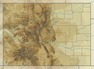
Jagged Mountain is a high mountain summit in the Needle Mountains range of the Rocky Mountains of North America. The 13,830-foot (4,215 m) thirteener is located in the Weminuche Wilderness of San Juan National Forest, 12.2 miles (19.7 km) south-southeast (bearing 159°) of the Town of Silverton in San Juan County, Colorado, United States.[1][2][3]
See also
References
- 1 2 The elevation of Jagged Mountain includes an adjustment of +1.787 m (+5.86 ft) from NGVD 29 to NAVD 88.
- 1 2 3 4 5 6 "Jagged Mountain, Colorado". Peakbagger.com. Retrieved November 5, 2014.
- 1 2 3 4 "Jagged Mountain". Geographic Names Information System. United States Geological Survey, United States Department of the Interior. Retrieved November 5, 2014.
Denver (capital) | |
| Topics |
|
| Society | |
| Cities |
|
| Counties |
|
| Regions |
|
| Federal |
| ||||||||||||||||||||||||||||||||
|---|---|---|---|---|---|---|---|---|---|---|---|---|---|---|---|---|---|---|---|---|---|---|---|---|---|---|---|---|---|---|---|---|---|
| State |
| ||||||||||||||||||||||||||||||||
| Trails |
| ||||||||||||||||||||||||||||||||
This article is issued from Wikipedia. The text is licensed under Creative Commons - Attribution - Sharealike. Additional terms may apply for the media files.